10 Days/ 9 Nights
$ 3500.00
Crater Camp is truly exceptional.
Sitting at 18,865 feet, it is the highest camping point on Mount Kilimanjaro, positioned just 475 feet below the summit.
We provide the option to camp at Crater Camp on both the Lemosho and Northern Circuit routes. Choosing this adds one extra day to the normal itineraries, making them the 9-day Lemosho Crater Route and the 10-day Northern Crater Route.
On all other Kilimanjaro routes, only the guides and climbers continue to the summit while the mountain crew stays at the high camp (such as Barafu). Opting for Crater Camp demands much more logistics as the entire supporting team and all equipment must climb an additional 4,000 feet beyond the usual limit. This is why Crater Camp routes come with higher costs.
From Crater Camp, hikers can choose to take a one-hour side trip to Reusch Crater or explore the surroundings near the Furtwangler Glacier. Reusch Crater is an extraordinary natural formation — nearly a perfect circle with an ash pit that plunges 400 feet deep and spans about 1,300 feet wide — a sight very few visitors ever get to witness. The video below shows its massive scale.
Though Crater Camp is highly appealing, spending the night at such an extreme elevation carries significant risks. Without proper acclimatisation, severe altitude sickness can occur.
For safety reasons, the 9-day Lemosho Crater and 10-day Northern Crater routes are offered only by special request and require approval from Almighty Kilimanjaro.
On arrival at Kilimanjaro International Airport, you will be greeted and transferred to Salinero B&B for an overnight stay. That evening, your head guide will brief you on the expedition, inspect your gear, and assist with the rental of any additional equipment you may require.
Elevation: 7,742 ft to 9,498 ft
Trek Duration: 3–4 hours
Distance: 6 km / 4 miles
Terrain: Rainforest
We leave Moshi and head to Londorossi Gate, a drive of roughly four hours, to complete the park entry procedures. From there, we continue by vehicle to the Lemosho starting point. Once at the trailhead, we begin our walk through pristine rainforest, following the path that leads to the first campsite.
Elevation: 9,498 ft to 11,500 ft
Hiking Time: 5-6 hours
Distance: 8 km | 5 miles
Habitat: Health
We continue on the trail leading out of the rain forest and into a savannah of tall grasses, heather and volcanic rock draped with lichen beards. As we ascend through the lush rolling hills and cross several streams, we reach the Shira Ridge before dropping gently down to Shira 1 Camp. Here we catch our first glimpse of Kibo across the plateau.
Elevation: 11,500 ft → 12,500 ft
Trek Duration: 3–4 hours
Distance Covered: 7 km / 4 miles
Habitat Type: Heathland
Today’s route takes us across the Shira Plateau with an easy walk through open moorland as we head towards Shira 2 Camp. This heath region is dotted with colorful wildflowers and the distinctive giant Senecio plants.
Shira 2 Camp → Lava Tower
Elevation gain: 12,500 ft → 15,190 ft
Hiking duration: 3–4 hours
Distance: 7 km / 4 miles
Terrain: Alpine Desert
Lava Tower → Moir Hut
Elevation change: 15,190 ft → 13,580 ft
Hiking duration: 2–3 hours
Distance: 6 km / 4 miles
Terrain: Alpine Desert
From Shira 2, we climb steadily east along a ridge, then veer southeast to reach the impressive Lava Tower — a 300-foot volcanic monolith. Leaving the main path here, we take a detour to Moir Hut, a quiet campsite located at the foot of the Lent Hills. The surrounding hills offer multiple short hikes, ideal for acclimatisation. The Shira Plateau itself ranks among the highest plateaus on the planet.
Elevation: 13,580 ft to 13,200 ft
Duration: 5–7 hours
Distance: 12 km / 7 miles
Terrain: Alpine Desert
You begin the day by leaving Moir Valley on a moderately steep ascent, then make your way up to the top of Lent Hills before rejoining the main track. The route passes over a rocky expanse and rolls gently up and down until you reach Buffalo Camp. Along this stretch you’ll be treated to wide-open views of the plains stretching north of Kilimanjaro, all the way to the Kenya–Tanzania border.
Elevation: 13,200 ft down to 12,700 ft
Trek Duration: 5–7 hours
Distance Covered: 8 km / 5 miles
Terrain Type: Heath zone
The ascent over Buffalo Ridge leads us into more barren terrain. Since few people take this path, it offers a raw, untouched mountain atmosphere. We continue through secluded valleys and along the northern face of Kilimanjaro until we reach Third Cave.
Elevation: 12,700 ft to 15,600 ft
Hiking Time: 4-5 hours
Distance: 5 km | 3 miles
Habitat: Alpine Desert
We climb steadily up and over the “Saddle,” which sits between Kibo and Mawenzi. We continue to our camp, School Hut. Once here, we rest, enjoy dinner and prepare for the summit day.
School Hut → Uhuru Peak
Elevation gain: 15,600 ft to 19,341 ft
Trek duration: 6–8 hours
Distance: 6 km / 4 miles
Zone: Arctic
Uhuru Peak → Crater Camp
Elevation loss: 19,341 ft to 18,865 ft
Trek duration: 30–60 minutes
Distance: 1 km / 0.6 miles
Zone: Arctic
In the early morning, we begin our summit attempt — the most demanding section of the expedition, both physically and mentally. We move slowly and steadily upward, pausing briefly but often. The trail becomes loose scree as we tackle the steep ascent to the crater rim. Once we reach Gilman’s Point (18,600 ft), we can see the summit sign in the distance. We follow the rim until we finally reach Uhuru Peak — the roof of Kilimanjaro and the highest point in Africa.
After celebrating at the summit, we make a short descent to Crater Camp, where the rest of the crew meets us and pitches the tents. If you have the energy, you may take a side hike to Reutsch Crater and the ash pit, or explore the surroundings near the Furtwangler Glacier. Because staying at this extreme altitude carries risks, especially if acclimatisation is insufficient, the guides will keep a close watch for any signs of altitude sickness.
Elevation: 18,865 ft → 10,065 ft
Trekking Duration: 4–6 hours
Distance: 12 km / 7 miles
Terrain: Arctic zone
From Crater Camp, we begin our descent and follow the path straight down to Mweka Hut, pausing at Barafu for lunch. The route is rocky and tough on the knees, so trekking poles come in handy. Mweka Camp lies within the upper forest region, where afternoon mist or light rain is common. In the evening, we enjoy our final dinner on the mountain and get some well-deserved rest.
Elevation: 18,865 ft ↓ 10,065 ft
Trekking Time: 4–6 hours
Distance Covered: 12 km / 7 miles
Landscape: Arctic zone
Leaving Crater Camp, we start descending directly toward Mweka Hut, taking a break at Barafu for lunch. The trail is rocky and can be demanding on the joints, so trekking poles are very useful. Mweka Camp is located in the upper forest belt, where afternoon fog or light showers are typical. In the evening, we enjoy our last dinner on the mountain and retire for a good night’s sleep.
Pick-up and drop-off at Kilimanjaro International Airport
Transfer to the trailhead - entry gate to Kilimanjaro National Park
Pick-up at the exit from Kilimanjaro National Park and transfer to the hotel
All park fees collected by the Kilimanjaro National Park ( conservation fees, camping fees, crew fees, vehicle fee, rescue fee and all other fees collected by the Tanzania National Parks Authority).
One night at Salinero hotel before the expedition and one night after; The hotels have everything for your comfortable stay - caring staff, nice rooms, reliable Wi-Fi, restaurant); Tented accommodation on Mount Kilimanjaro (modern, comfortable 4-Season tents North Face VE-25 or Almighty Kilimanjaro Tents).
Breakfast in the hotel before and after the hike
All meals on the hike. Our Kilimanjaro diet includes energy-rich and highly nutritious meals prepared by our professional high-altitude cooks. A typical diet on Kilimanjaro includes different soups, garnishes, several types of fish and meat, fresh fruit and vegetables; vegetarian/gluten-free/halal options are available at no extra cost; All drinks on the hike (coffee, tea, hot chocolate and water).
4-inch (10-cm) thick and comfortable sleeping mats
All group equipment (spacious and comfortable dining tent, camping table and chairs, crockery and cutlery)
Oxygen cylinders and oximeters
GPS-tracking service
Complete medical kits
Professional guides, licensed by Kilimanjaro National Park. All our guides are the holder of Wilderness First Responder or Wilderness First Aid certifications. All our guides have 10+years of successful mountaineering experience.
Dedicated support crew (assistant guides, camp master, porters, cooks, etc.)
Airline tickets
Visa fee
Personal gear rentals
Tips for the mountain crew
Mountaineering insurance
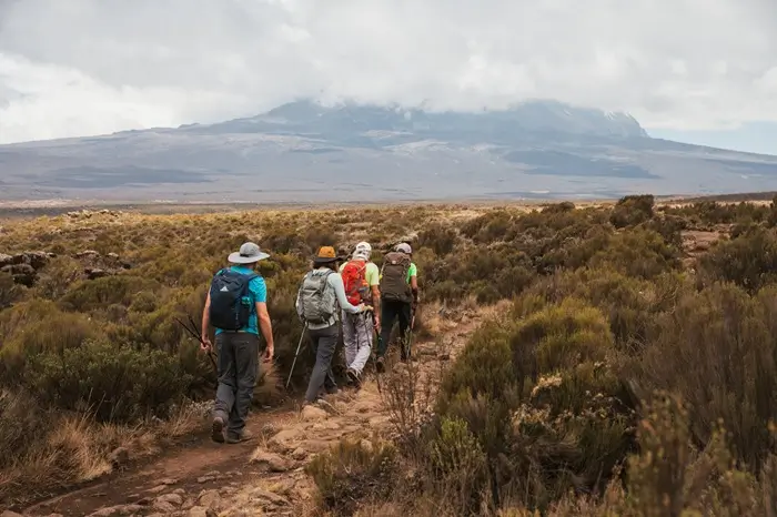
The best time to climb Mount Kilimanjaro is during the two trekking seasons: January to March and June to October. These periods offer favorable conditions for a safe and enjoyable climb.
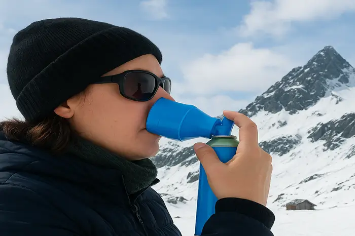
The percentage of oxygen in the atmosphere at sea level is about 21%. Before planning your Mount Kilimanjaro Trip, it is crucial to explore the cost of climbing Kilimanjaro.
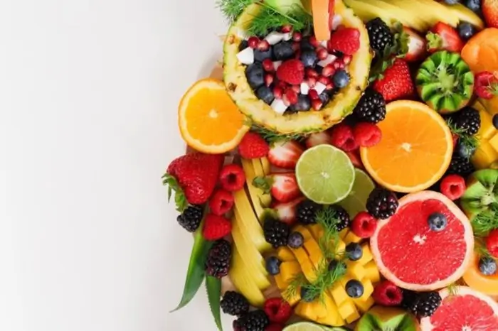
For high-altitude treks like Kilimanjaro, proper nutrition is crucial for maintaining energy levels and ensuring a successful climb. You will need nutritious foods to gain proper energy.